|
|
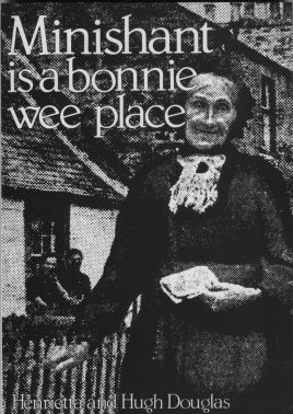
Minishant is a bonnie wee place. Portrait of a Village by Henrietta and Hugh Douglas. Line drawings by Michael Ellis. Strathprint, 146 Broadway Peterborough. First Published 1982. Copyright © Permission for display on this site granted by Hugh Douglas. You may view and download chapters of this book for personal research purposes only. No other distribution of this text is authorized. Click here for other books by Hugh Douglas. Cover: Mrs. Margaret Limond, was Minishant postmistress until she died aged 94. |
Hugh Douglas
First clear memories are hard to bring to mind because they are a rag-bag of scraps of experience. I was born at Monkwood Mains and a host of half-blurred remembrances merge into an impression of a place which was peaceful, secure and happy. My parents had taken over the farm after Granny On and Great Uncle Willie died in the early 1920s and Great Aunt Bella went off to Ayr to retire.
I was born on the 15th February 1928, and much of my early childhood was spent in the company of my grandfather who lived with us. We walked a lot together and met and talked with people, mostly those of my grandfather’s generation. Once we found a young owl which had fallen from its nest and we brought it home and reared it. Jimmy, as we called him, grew up and left us but returned most nights for a piece of meat which was always left out on a window sill. On another walk I remember we ended up (as I suspect we often did) at Burnside, the old school-house at the foot of our farm road. I remember sitting on a wooden blanket chest listening to my grandfather talking to the old schoolmaster’s brother-in-law, Jimmy Limond, who lived there alone. He must have been 90 at the time and had fantastic memories of the village, but I was too young to take them in.
The room was typical of others in the but and ben houses which I came to know well when I grew old enough to deliver milk for my father. It was tiny, crowded and lit only by a small twelve-paned window which faced directly on to the road and another, about a foot square, which overlooked the burn. I must have been hoisted up to look out one day, for I still feel a dread of that room high above the burn. This was the "but" or kitchen end of the house, crammed with pictures, jugs and ornaments, and dominated by a tall scrubbed dresser and an enormous open range which served to cook all the food and to heat the room. I have a vivid picture of sitting on the chest, legs dangling in the air, watching the reflections of the flames of the open fire dance jigs on the well polished black and shiny steel grate. No doubt I had plenty of time to ponder the room for my grandfather was a great character with friends all over the countryside and, by then, plenty of time to crack with them.
Life in the village, so far as I was concerned, centred round the school, Sunday school, hall (created by the villagers themselves from that mill which was derelict at the time Mother first came to live in Minishant) and of course the shop where Mrs. Harrison's daughter, Mrs. Hunter, now doled out sweeties in cone-shaped "pokes" fashioned from squares of old newspaper and ha'penny slabs of Battleaxe toffee broken off a penny bar with a little hammer in the shape of an ancient warrior's axe. It was worth a ha'penny just to see Mrs. Hunter wield the axe as deftly as Bruce raised his to cleave de Bohun's head on the eve of Bannock-burn. When we were sent to buy a packet of cigarettes for my father or one of the men (strictly illegal but who cared,) we were always given a shilling and allowed to buy sweeties with the ha'penny change. It was my sister who devised the scheme when the shop was shut of buying the cigarettes from the automatic machine at the garage, slitting the cellophane wrapper and removing the ha'penny which was inside. That way we were able to buy our sweeties later -toffee or soor plooms, black striped balls, liquorice straps or sherbert dabs which always included five wee orange-coloured sweeties in the shape of flowers. That last was my favourite because it always seemed so much more.
We ran a telegraph pole and walked to the next to speed us up on the way to school and on Sundays we played high tig in the church grounds until the Sunday school bell rang -how grown-ups tolerated such unkirkly behaviour I'll never understand. The reward for learning the Shorter Catechism and singing Jesus Loves Me week by week was a party in the hall at Christmas and an outing by bus to Girvan each summer.
These were the highlights of the year for a child in Minishant in the 1930s, and with so little work and money around they shone out against the drabness of the rest of the year. Few of us were taken anywhere beyond Ayr except perhaps on an annual visit to relatives in the next county. To be born in Minishant was to belong to it and to have roots in no other place.
My Minishant roots went deep. Mother's family had been in the village since the 1870s, but Father's connection can be traced back a century more. In Alloway Auld Kirkyard there are tombstones to my great-great-grandfather John Douglas who farmed Blackbyres until his death in 1899, and to the Boyd family (Father's maternal grand-mother's connection) who lived at Culroy and one of whom was the Ivie Boyd born in the same year as Robert Burns.
On all of these old gravestones at Alloway or Maybole there is no mention of Minishant, although the village has the look of a place which must have been there for centuries - a solid established appearance which suggests that dynasties of kings may have come and gone but the village has survived all the changes. It's a surprise, therefore, to discover that the name does not appear on any map before the middle of the 19th Century.
Apart from Timothy Pont's survey which was made about 1611 and published by Blaeu in Amsterdam in 1654, little attempt was made to produce a really accurate map of Ayrshire until the 18th Century when there was a great rush of map-making throughout Scotland.
If you study A. and W. Armstrong's map of 1775 you will not find Minishant. Where the village ought to be there is only bleak, marshy landscape with hardly a dwelling marked and no roads within a mile. It is crossed by several small burns, most of them almost narrow enough to step over, and every one as twisted as a thrawn auld body, never satisfied with the direction in which he is going. Over the years these streams have dug beds deeply into the soil, and at many points rocky outcrops have forced them to change course suddenly, leaving steep "scaurs" carved into the exposed rock.
The Armstrongs did not discover that the largest of the burns had a Gaelic name, Polnatibber, describing it exactly -the twisting, winding stream. By their time it was known as the Culroy burn because Culroy was the territorial name for all that country between the Brown Carrick foothills and the river Doon into which the Polnatibber or Culroy burn debouches between Auchendrane and Monkwood houses.
Hills in the district are generally low, but have the appearance of being higher than they actually are because the valleys have been deeply cut by millions of years of weathering by wind, water and ice. Brown Carrick Hill, the highest, is only 912 feet above sea level, and from Minishant it looks little more than a low blue band along the western horizon.
On the Armstrongs' map the main road from Ayr to Maybole passes along the lower slopes of Brown Carrick, and at the time the map-makers made their survey this was a well worn track which had served travellers for centuries already, letting them pass dryshod on high land above the boggy valley. Robert the Bruce must have passed that way between his home at Tumberry Castle and Ayr, mediaeval kings and barons rode along it on pilgrimages to Whithorn, and Mary Queen of Scots travelled it. This was also the way William Burnes walked regularly in the late 1750s while he courted Agnes Broun, a farmer's daughter whom he first met at Maybole fair. In due course it was the road along which they took their son, Robert Burns, to be admired by his Broun relations at Maybole and Kirkoswald.
The other road south from Ayr branched off the main Ayr-Maybole road at Blairston, just south of Alloway, and followed the south bank of the river Doon past the present-day farms of Monkwood Mains and Midton and close to Cassillis.
In the late 18th Century the first farms as we know them today, were being enclosed, and there are plenty of familiar names on Armonstrongs' map - Midton, Milton, Grange and so on - but they are not always accurately located. Where Minishant now stands, a single building is marked and named Culroy, while the site of the present hamlet of Culroy, a mile or so up the Polnatibber burn, is called Culroy Smithy. Another name in common use for the group of houses on the high road was Culroy Bridge.
When John Thomson came to produce his atlas of Scotland in 1831, the two settlements were similarly named, and it is only a generation later, on the first six inches to the mile Ordnance Survey map, surveyed in 1856 and published in 1860, that the village is at last named Minishant. It was spelt Minnyshant, the same spelling as can still be found on the signpost at the crossroads on the Kirkmichael road just beyond Burnmouth. By that time it was laid out virtually as it remained until the late 1930s.
Slater's Royal National Commercial Directory and Topography of Scotland, published in 1867, refers to the village of Culroy or Minishant, suggesting that the village, which had grown rapidly in the first half of the 19th Century, had only recently changed its name.
On the face of it this could be simply a case of what geographers call a transferred placename - a common enough occurrence - but why should the transferred name be replaced with an old Celtic one, never recorded on any surviving early map or document? And why did this happen at a time when most new placenames were English or Scottish rather than Gaelic? The farms in the district conform to this 18th and 19th Century custom -Monkwood, Midton, Blackbyres, Kewnston, Milton, Burnmouth, Woodston and Blackhill. Older settlements like Auchendrane and places on the ancient high road have names of Celtic origin - Pinmore, Knockdon, Beoch, Sauchrie, Craigskean and so on.
So against every trend, Minishant was given a Celtic -and probably older - name. But was it a genuinely older indigenous name or just a Celtic name put on it by some incomer? Perhaps a clue lies in its meaning. Minishant is derived from two words, "moine", a peat bog or "muine" a thicket, and "seant", holy or concealed. Was this a holy place beside the peat bog, or perhaps a hidden place near a marsh? Professor Watson, spelling the name Minnishant, says that it means "holy moss" or "holy shrubbery". Kevin McDowall, in Carrick Gallovidians, prefers "field of the concealed fortress". More recently, James T. Gray, of Maybole, translated the name as "the field or marshy place of the holy man", which fits in with the scanty clues we have to the early history of the district, and the strong tradition that there was a religious settlement in the area.
One thing is certain - the name is not derived from the story long popular among local children that Minishant and Culroy were named at the same time as a result of a quarrel among passing gypsies. When one of the tinker woman threatened a young man, an older one is said to have intervened, saying "Minnie shant kill Roy".
So much for romantic Victorian legend to explain away two place names which people knew were linked in some way. Minishant's name undoubtedly is of Celtic origin, and unless it was some equally romantic Victorian who brought in the name, it must date much further back into history.