|
Maybole,
a parish containing a post town of its own name, also the villages of
Culroy, Dunure, and Fisherton, in the north-west corner of the district
of Carrick, Ayrshire. It is bounded by the frith of Clyde and by the
parishes of Ayr, Daylrymple, Kirkmichael, and Kirkoswald. Its greatest
length in a straight line, is 9 miles, but by the nearest practicable
road is 12; It’s greatest breath in a straight line is 5 miles, but by
the nearest practicable road is 7; and its area is 33 1/4 square miles.
The eastern and south-eastern districts are an undulating plains, very
diversified in surface, never subsiding long into a level, nor ever
rising into decided upland. The other districts are a sea of heights,
partly arable, and partly pastoral, so pleasingly and rapidly
diversified in superficial outline as to want nothing but a free
interspersion of wood to be delightful rambling ground to a lover of
fine scenery. Along the middle of the hill district, parallel with the
frith, and 1 ½ mile distant from it, stretches a range of summits
nearly 4 miles long, attaining an extreme altitude of 924 feet above
sea-level, and bearing the name of Brown Carrick hill. This range,
though heathy in itself and rising like a screen to intercept a view of
the frith and its frame-work from the interior, commands one of the most
gay, magnificent, and extensive prospects in Scotland. On the south-east
and south stretches the surgy surface of Carrick, expanding away in
alternations of green height and brown bold upland till it becomes lost
among the blue peaks of the southern Highlands of Scotland; on the
south-west and west are the broad waters of the frith of Clyde, with
many a sail like a sea-bird skimming the surface, and the rock of Ailsa
riding like an ark on the wave, while behind are the serrated mountains
of Arran veiled in misty exhalations , or curtained with clouds of every
form and hue; on the north, immediately under the eye, extends the deep
sylan furrow of the Doon with the monuments of Burns glittering like a
gem on its edge; and away thence stretches the great luxuriant plain of
Kyle and Cunningham pressed inward in a long sweeping segment by the
frith, gaily spotted with towns which look like cities in the distance,
chequered also with a profusion of mansions and demesnes, and gliding
dimly away in the perspective into the gentle heights of Renfrewshire,
over-looked in the far horizon by the blue summit of Benlomond. The same
prospect, in much of its extent and most of its elements, is seen from a
thousand vantage-grounds inspiriting land of beauty; but nowhere are its
scope so unbroken, its groups so superb, and its effect upon the mind so
exquisitely thrilling. Should any one wonder that Burns grew up on the
threshold of this home of romance, and for many years might have daily
gazed on its gorgeous visions, and yet has not made an allusion to it in
his writings, he must remember that the bard, though possesing a keen
eye for the beauties of nature, was the painter rather of manners than
of landscape,-the type of poetry not of Salvator Rosa, but of Hogarth
and the limners of Holland.
The river Doon, over 4 ½ miles in a
straight line but 7 or 8 along its numerous curvatures, forms the
boundary-line on the north-east. But over ½ of a mile above its
emouchure it forsakes its ancient bed, and places a small portion of the
parish, a piece of haugh-ground on its right bank. Along nearly all its
connexion with Maybole, it has a deeply furrowed, dell-like path,
profusely covered with copsewood and trees. Girvan water forms the
boundary for a short distance on the south-east and is there a mirthful
fine-clad stream. Rannochburn, running 2 ¾ miles westward along an
entwisting glen to the sea, traces part of the southern boundary. The
interior running waters, owning to the configuration of the surface, are
mere rills; but the largest gathers a considerable volume in five or six
sources on Brown Carrick hill, and runs in an easterly course of 4 miles
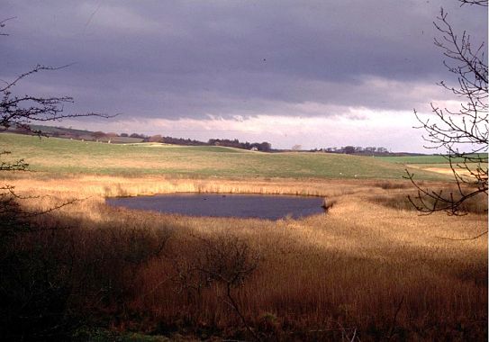
to the Doon near Auehendrane. Of four or five tiny lochlets, all lying
in the south-east, the only noticeable one is Heart-loch; whose outline
is exactly designated by its name, and whose appearance in a wooded
hollow, with vegetation coming freely up on the outer surface of its
waters, is softly beautiful. Perennial springs of excellent water are
numerous, especially on the site and in the vicinity of the town; and
one of them, called the Well-trees’ Spout, emits a stream powerful
enough to drive a mill wheel, or between 160 and 170 imperial gallons
per minute. Of various mineral springs, formerly of medicinal repute,
but all now neglected, the most remarkable is St. Helen’s-well, 2 ¼
miles north of the town on the high road to Ayr,-anciently associated
with Popish superstition, and reputed to have the power on Mayday of
healing or invigorating sick or delicate infants.
The geological structure of the coast
presents an interesting correspondence in its strata with those of the
confronting coast of Arran. The predominant rocks of the interior are
old red sandstone and trap. The sandstone, in a quarry at St. Murray’s
often affords beautiful specimens of arborescence, from the presence of
the black oxide of manganese, and is traversed by veins of lead ore. The
soil of the arable lands is partly of a light nature, and partly of a
strong, clayey character. About 17,000 imperial acres are in tillage;
nearly 1,000 are under plantation; about 570 are meadow; and the rest of
the area is variously moorland and hill pasture. The principal
landowners are the Marquis of Ailsa, the Right Hon. T. F Kennedy of
Dunure, Sir James Fergusson, Bart. Elias Cathcart, Esq. Of Auchendrane,
Sir David Hunter Blair, Bart. and four others. |
|
The
estimated value of raw produce in 1837 was £
47,552. Assessed property
in 1855-6, £
28,592. The parish is traversed by the road from Ayr to
Girvan, and has a branch railway of its own, completed and open for
traffic in September 1856, and going into junction with the Ayr and
Dalmellington railway. There were in the parish, in the feudal times, at
least fifteen towers or castles, the residences of brawling chiefs.
Dunure-castle, an interesting extant one of these, has been noticed in
our article on Dunure. Grenand, or Greenan castle, half-way between the
mouth of the Doon and the Heads of Ayr, is a tall, qaunt, lanthorn-looking
pile, rising nakely upon the margin of the sea, on an elevated bank,
overlooked by a bold ascent;and, as seen with the Clyde for its
back-ground it has a haggard aspect, striking suggestive of the misery
of feudal times. The castles of Newark, Maybole, and Kilkenzie, have
recently undergone renovation or repair, and are at present inhabited;
but all the others- the castles of Auchendrane, Smithstown, Beoch,
Craigskean, Garryhorne, Doonside, Dalduff, Glenayas, Sauchrie, and
Brochlock- are much dilapidated, or have left but a few vestiges.
Numerous camps occur, so small and of such
rude construction, as evidently to have been thrown up by small invading
bodies of those Irish who subdued the Romanized British tribes. Tumuli,
the burying places of a field of carnage, are frequent around it,
tyrannized over in ancient times by the Kennedies; and exhibits not a
few memorials of disasters inflicted, or of conflicts maintained, by
them and their underlings. Population in 1831, 6,287; in 1851 7,615.
Houses 948.
This parish is in the presbytery of Ayr,
and synod of Glasgow and Ayr. Patron, the Crown, Stipend, £335’7d.;glebe,
£30. Unappropriated teinds, £51 19s 3d. Schoolmaster’s salary, £34
4s 4 ½d, with about £100 fees. The parish church was built in 1808,
and altered and improved in 1830, and contains 1,192 sittings. There are
two chapels of ease, the one at the west end of the town, built by the
later Sir C. D. Fergusson; the other on the coast, at Fisherton. There
is a Free church in the town and the amount of it’s receipts in 1856
was £647 9s. 1 ½d. There is an United Presbyterian church in the
centre of the town built in 1797 and containing 555 sittings. There is
also an Episcopalian chapel. There are six non parochial schools. The
present parish of Maybole comprehends the ancient parishes of Maybole on
the south and Kirkbride on the north. The church of Maybole, anciently
dedicated to St. Cuthbert, was given in the reign of Alexander II by
Duncan of Carrick, son of Gilbert of Galloway, to the Cistertian nuns of
North Berwick, whose convent was founded soon after 1216; and continued
to belong to them, and to figure as a vicarage established by the bishop
of Glasgow, till the Reformation. The entire revenues of the vicarage
were estimated in the reign of James V. at only £ 53 6s
8d. and half of
even these were annexed for some time before the Reformation to the
prebend called Sacrista Major in the collegiate church of Glasgow. At
the Restoration, the revenues of the parsonage, the glebe excepted, were
held on lease by Thomas Kennedy of Bargany, for the yearly payment of
£22, twenty oxen, and twelve cows. In 1451, a chaplainry was founded in
the church by Sir Gilbet Kennedy of Dunnure, dedicated to St. Ninian,
and endowed with the lands of Largenlen and Brochlock. A chapel,
subordinate to the parish church, anciently stood on the lands of
Auchendrane; and other chapels, in other parts, were traceable at the
end of the 17th century. The church of Kirkbride was given to
the same parties as the church of Maybole and by the same donor, and
continued in their possession till the Reformation. The annexation of it’s
parish to Maybole occurred probably in the days of Popery, and certainly
before 1597. In that year, the church of Maybole figures as the place of
worship for both parishes, and by an act of parliament, was formally
separated from the convent of North Berwick, and established as a
rectory. The ruins of the church of Kirkbride, on the shore about
half-a-mile north of Dunure castle, are still distinctly observable,
surrounded by a burying-ground which continues to be used, and in the
vicinity of a field which bears the name of the priest’s land or
glebe. In 1371, Sir John Kennedy of Dunure, founded, near the parish
cemetery of Maybole, a chapel for one clerk and three chaplains,
dedicated it to the Virgin Mary, and endowed it with the five mark lands
of Barrycloych and Barrelach, the six mark lands of Trechan, and various
other sources of revenue. This collegiate chapel seems to have been the
earliest establishment of its class in Scotland; and afterwards, when
similar ones arose, it was called a collegiate church, and its
officiates were styled provost and prebendaries. During part of the
reigns of James III and James IV., Sir David Robertson was provost; and
, in 1525, Mr. Walter Kennedy, rector of Douglas, canon of Glasgow, and
rector of the university of Glasgow, was appointed to the office. The
ground on which the town stands belonged to the collegiate church. Two
houses, which were the domiciles of two of its priests, and orchards,
which belonged to the domiciles of the others, still exist. The church
itself is now the burying-place of the Marquis of Ailsa and other
parties, whose ancestors arrested the progress of the pile toward ruin;
and is surrounded by a planted and neat path of round enclosed with a
wall.
|