 |
|
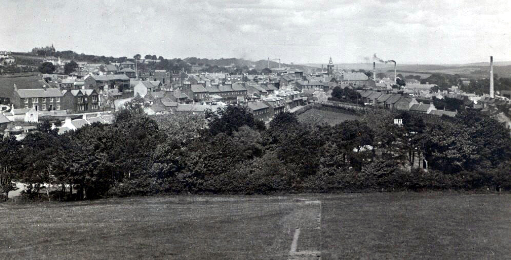
This a photo which has caused quite a bit of discussion on Facebook recently. Many existing properties can be seen and some of the controversy was around the houses overlooking the field. Are they Ladywell Road or Hutchison Street? After closer scrutiny they would appear to be, indeed, Hutchison Street. The three-house terrace in Kirkoswald Road can be clearly seen, and to its right the semi-detached pair with the crow-foot gables above their bay frontages -- they are number 4 and 6 in Kirkoswald Road. Also seen are houses in Gardenrose Path and then Ashgrove clear on the horizon plus of course the Town Hall, Welltree Street and some chimneys from boot and shoe factories. The postcard came from Scott McIlvain whose ancestry is on www.maybole.org and is thought to be from about 1910. What is the path though in the front of the photo and where is the West Church? Is it the path to the war memorial which would mean it is after World War II? So is it not the memorial path? And so is the postcard from an arbitrary time before 1920 and not linked to the creation of memorial park at all??? Questions, questions. |