|
MAYBOLE (AUSTRALIA)
REVISITED - BY JIM DOUGLAS |
|
|
Back in 1972 I spotted
the sign. On a professional adventure, I was driving
a new liquid carbon dioxide road tanker up the main
inland highway from Sydney to Brisbane. There at the
roadside was a sign pointing to Maybole.
Unfortunately I could not find a place to park my
bulky roadster for a closer look. However, later in
my sojourn down under, I passed that way again when
on an interstate move with my family, and managed to
pull into the roadside for a photo of the sign.
Sadly, time did not permit further exploration.
On my return to meet
up with former workmates in 2010, Barrie had
contributed to my itinerary by offering to take me
up to north New South Wales with the aim of looking
over his bushland property and to attend the Glen
Innes Celtic festival. We followed much of the same
route north, although I could not remember where to
look. The road was vastly upgraded, but I kept
looking for that sign. |
 |
|
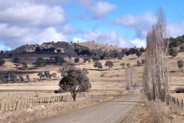
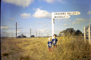
1972
Jill and Kirsten at Maybole Sign |
|
|
 |
We
got to the bushland property without sight of it. Having
done a traditional walkabout, we moved east over to Glen
Innes and the festival - sporting my Douglas kilt of course.
To expand our knowledge of the Glen Innes attractions, we
visited the information centre. On the wall was a large
scale pictorial map, and there, 20 miles or so to the south
was a red marker dot, and the name - Maybole. Discussion
with Dorothy in the centre provided road directions, and
Barrie aided and abetted my quest by heading down the
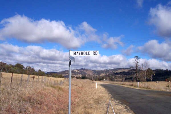
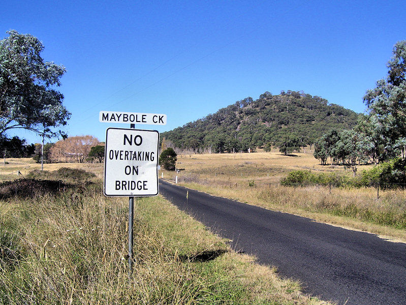
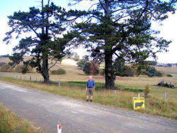
following day. Sure enough, the sign on the main highway
had disappeared, but we kept going up the hilly dirt roads.
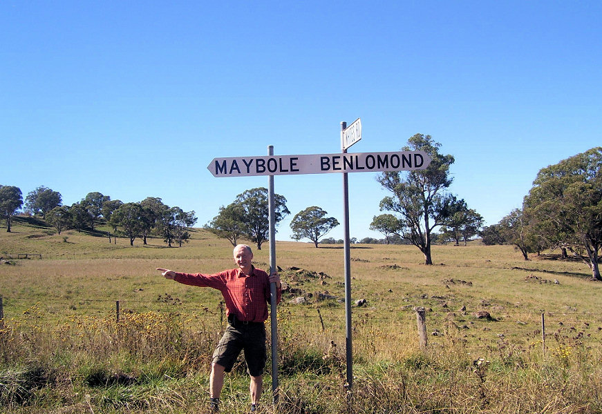
Perseverance brought us to a direction sign pointing
rewardingly to......... Maybole! So, on we travelled, with
Barrie's little car raising lots of dust in rolling hills of
the high dividing range. |
Bumping
along, I kept looking out for the elusive Maybole. Then
came another sign, this time pointing back the way we had
come! All we had passed were a couple of remote farms. So,
where was Maybole? We stopped at the entrance to one of
the farms, and I went to the buildings to seek information.
No luck - the farm house was derelict. Meanwhile Barrie who
had stayed with the car managed to get the attention of a
rare passing driver who turned out to be the district
postman. From this source of local knowledge came
confirmation that we had been as close as it gets to
Maybole. It was a lovely rural area, and we had enjoyed
the run, but Glen Innes called again for another event
Next day,
we visited the Glen Innes community museum, contained in a
former hospital building. It was well set out and
maintained. We had been told about a couple of historic
farm tractors at the museum, but saw no trace of them. A
word with the curators led to a very helpful archivist
coming out of her office and taking us to a locked shed to
see our tractors. I took the opportunity to quiz her about
the elusive Maybole, and she responded by confirming my
fears that Maybole community was no more.
That was
not the end of the quest, as our museum friend confirmed
that Maybole had once boasted a recognisable population and
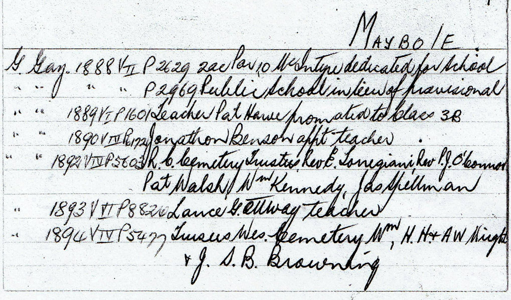
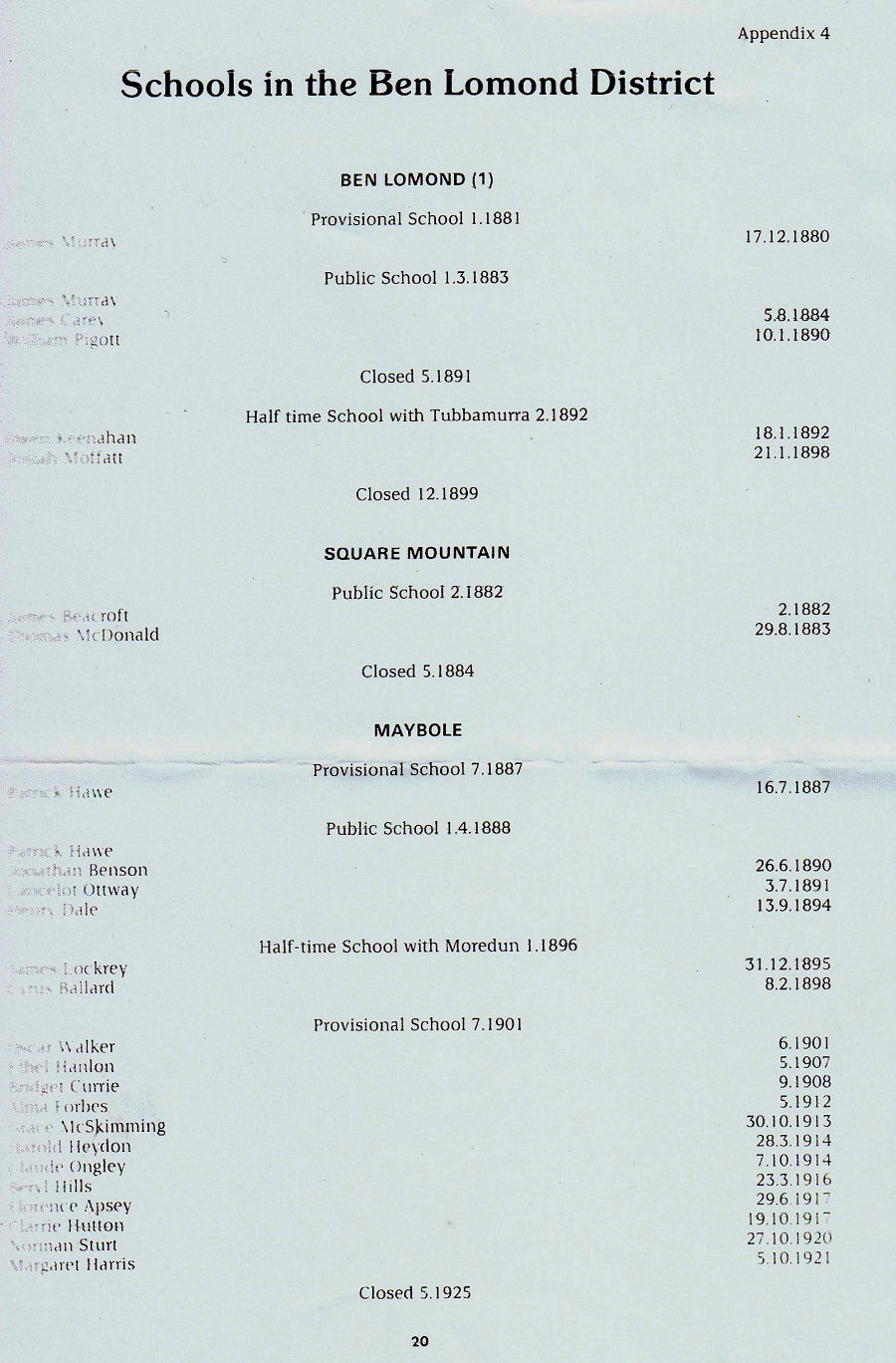
even a primary school. The school was recorded as having
existed from 1887 to 1925. A card was produced and
photocopied for me. (See below) It also transpired
that Dorothy from the information centre actually lived up
in the very area, in the adjoining 'parish' of Ben Lomond.
Does that make sense? Directions were given on how to reach
Dorothy's place through the surviving village of Ben Lomond.
 |
 |
 |
|
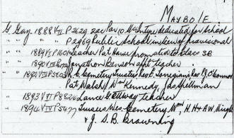
Maybole
school and area historical notes |
School
in Maybole 1887-1925 |
Former site
of Maybole school |
On the
following day, when finally departing from Glen Innes, we
diverted up through Ben Lomond, and beyond to seek out
Dorothy. Eventually we found her and husband John at their
lonely home, aptly named ‘Silent Grove’. We were made
welcome and out came more facts about Maybole. The
school had been removed and partly used in the construction
of a farm building, but we could find its site next to two
tall pine trees. Dorothy copied a document relating to
local schools for me. (above) In the area were
the remains of a private cemetery. Apparently only the name
'Wright' could be discerned on the graves
With our further information,
we drove back to our previous scene of exploration.
Eventually we saw the two tall pines, but no trace of the
former school. We did not attempt to find the graves as
time was pressing to continue our journey back south. The
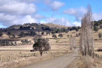
scenery was beautiful in the remote and silent range of
hills. One of our contacts had confirmed that the range was
formerly volcanic. There was also a tale that there was a
distinct "bowl" shape at Maybole, and even a hint that some
had confused the derivation of Maybole through the
phonetics. |
|
|
|
We headed back towards
the highway, again passing through the village of
Ben Lomond. The tale of Maybole could not be closed
without noting our further observations. Partly
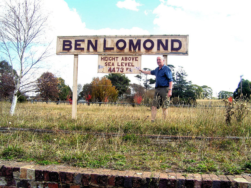
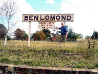
spurred on by my railway years, we stopped and
walked over to the former railway station that we
had been told was once the highest in Australia. The
rails were still in place, though overgrown.
Pleasingly though, the station building seemed to
have been preserved, and on the platform sign was
the legend "Ben Lomond - 4,473 feet above sea
level"! So, if our highest Scottish mountain Ben
Nevis is only 4,400 feet, how did Ben Lomond grow
this high? |
 |
|
|
Back in Sydney, I did what I
should have done before the journey north. On Googling
‘Maybole Australia’, there was the map location and a couple
of photos of the area and sign. There was a comment from Ann
Williams (see story below) confirming that she too had found
the site but "there wasn't much there". |
|
|
 |
 |
|
The two photos above were taken by Ann Williams on her trip to
Australia. Click on the images to view full size.
|
|
I did visit
the Maybole area and although I took photos, there wasn't much
there. Didn't get any more information on how it came to be named.
The local information office at Glen Innes was very helpful but not
when it came to information about Maybole. Its a farming area and
very brown. Not like our lovely green fields. They're very proud of
their Scottish ancestory and there's a lot of tartan and all things
Scottish all over the place. ...Ann Williams |
|
 |
Maybole NSW is actually a locality on the border of
Inverell Shire and Severn Shire, in the New England area of New South
Wales. Its very sparsely populated and has no significant features that
can be readily identified. It is very much off the beaten track. There is
no cultivated farming in the area, but a few buildings are visible
scattered across the area.
I've been unable to locate much detail about
the history of the locality or why it was named Maybole, but I have been
told that Maybole operated a primary school during the years 1887-1925.
The operation was patchy, at times it was only a part-time school, and was
classed as a provisional school for much of its operation, which meant
that its enrollment was less than 15 students.
I'm sure that it must somehow be connected to our town. I can't find any
other Mayboles in the world, apart from the place in Victoria which we
already know about.
Ann Williams
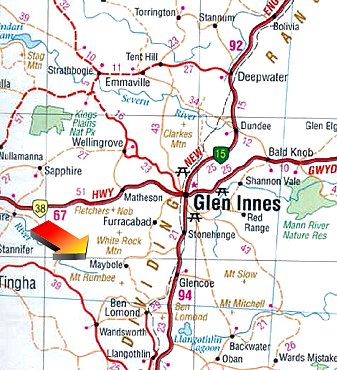
View another more detailed map of Maybole, New
South Wales |
|
Maybole (locality) is
approximately 16-18ks North West of Ben Lomond on the Great dividing
range. Height would be approx. 1391 metres.
Silent Grove Farmstay Bed & Breakfast is 7k from Ben Lomond on the
Maybole road and that is our height. It has very steep hills and is
usually a high rainfall area. In the months of June, July and August, at
1,000mm, there are light to moderate snowfalls in winter which last a day
or two with overnight minimum temperatures dropping to minus 8c or on
occasions slightly lower. The area grows prime lambs, merino and cross
bred sheep and cattle. There are also feral deer, pigs and goats in the
area. Shooting is not allowed. Rabbits and foxes are also a problem. There
was a school in the area opened in 1887and closed 1925. There was a post
office but I am not sure when this closed. Dorothy
Every |
|
|
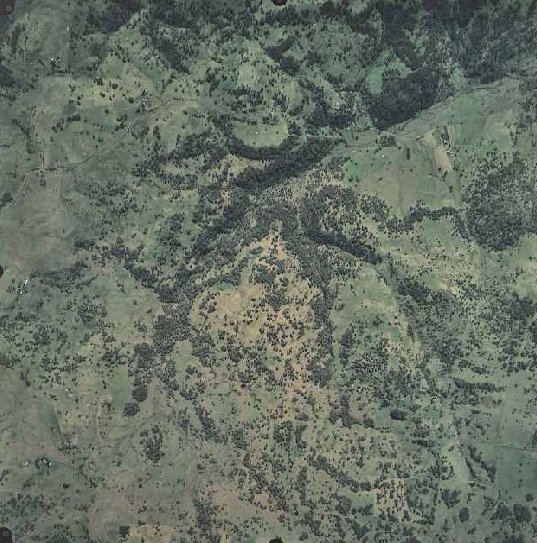
Aerial Photo of Maybole, New South Wales, Australia.
Photo taken November 2001 at an altitude of 4,947 meters.
Coordinates
Longitude 151 36'
49",
Latitude -29 54' 13" |
|