|
 A
quest for an early map of Strathearn, Perthshire, led me
to "The Pont Manuscript Maps of Scotland - 16th Century
origins of a Blaeu Atlas" by Jeffrey C Stone and to the
fascinating and unexpected discovery that with the
printing in 1654 in Amsterdam of Joan Blaeu's "Atlas
Novus", Scotland became one of the best mapped countries
in the world. It seemed incredible thatTimothy Pont, the
first person to put Scotland `on the map' had merited no
memorial and no mention that I could find in history
books. A
quest for an early map of Strathearn, Perthshire, led me
to "The Pont Manuscript Maps of Scotland - 16th Century
origins of a Blaeu Atlas" by Jeffrey C Stone and to the
fascinating and unexpected discovery that with the
printing in 1654 in Amsterdam of Joan Blaeu's "Atlas
Novus", Scotland became one of the best mapped countries
in the world. It seemed incredible thatTimothy Pont, the
first person to put Scotland `on the map' had merited no
memorial and no mention that I could find in history
books.
Details of the first
Scottish cartographer's life are scant. His father
Robert Pont (1524 - 1606) was a renowned ecclesiastic
and by the 1590s a statesman advising "in all matters
concerning the weal of the Kirk." Like his father,
Timothy studied at St. Andrews University, graduating
about 1583. In the next few years, having been made
financially secure by his influential father, for some
reason he turned aside from a strict career course
within the Church and embarked on a great adventure.
Whether at the command of James VI perhaps wanting an
inventory of his kingdom or of the Reformed Church
authorities needing to record the settlement areas of
its parishioners, young Pont spent the next twelve years
or so travelling widely through Scotland recording the
land as he saw it. His manuscript drawings were the sole
surviving record of this mammoth undertaking. But what a
record!
There are no details
of the planning and logistics which such an undertaking
would have involved, but we can well imagine the hazards
Timothy Pont must have experienced travelling without
written directions through a country of few good roads
at a time of unease and suspicion of strangers. Here was
a man who must have asked countless questions about
places and buildings, who drew pictures of what he saw
and wrote down the names he was told. It's a wonder he
wasn't killed as a spy!
Because at that time
waterways provided the main means of transport, areas
around these are depicted in greater detail in his
sketch maps than the far more sparsely inhabited
hinterlands. Pont concentrates on human habitations from
small fermtouns to larger settlements and to towns
themselves. Many Churches and Abbeys are depicted, but
more numerous are the castles and large houses of the
landowners and lairds, which appear in
architectural-like drawings When magnified these reveal
a striking picture of the buildings and grounds, the
storeys and windows, towers and gateways that Pont
actually saw - an invaluable record of 16th century
Scotland. Even allowing for idiosyncracies of spelling
at that time, the identifying names on these sketch maps
reflect the way in which they were pronounced - surely a
research topic in itself.
Before the dawn of the
17th century, Pont's travels had come to an end and he
had become minister of the parish of Dunnet in
Caithness. There he lived at least until 3rd May 1611,
according to a bond of that date which declared that he
and "Isobell Blacadder his spouse" lent 1000 merks to
the Earl of Caithness (an interesting slant!). He is
thought to have died shortly thereafter with all but one
of his manuscript maps unpublished.
The subsequent travels
of these original sketches and the work-ups made from
them to engraving standard read like a detective story.
At some time before 1629 the collection was bought from
Pont's heirs by Sir William Balfour of Denmilne, Fife,
an "antiquary and renowned collector of historical
sources." Although apparently intending to publish the
maps, he never did so. The Dutch printers, Willem and
Joan Blaeu, heard of the manuscripts through Sir John
Scot of Scotstarvit, in Fife, and by 1630 they were in
correspondence. During the following years Pont's
original maps were sent to Amsterdam. Over 30 of them
were then engraved, but the rest were not in a good
enough state. This meant, of course, that gaps remained
in the coverage of Scotland. At least some of Pont's
sketch maps were then returned and passed to Robert
Gordon of Straloch, Aberdeenshire, who prepared further
drafts for Blaeu to print in his "Atlas Novus". It is
our tremendous good fortune that so many original Pont
manuscript maps, having survived their subsequent
travels both in and out of Scotland, are now held in the
Map Library of the National Library of Scotland in
Edinburgh.
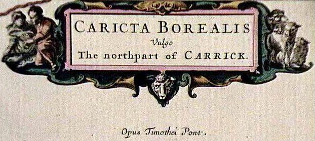
But here's the rub:
none of Pont's manuscript maps appears to have survived
for any part of S. W. Scotland west of Nithsdale. Though
all the maps of South Scotland in Blaeu from Berwick to
Ayrshire indicate their origin by the words Auct. Tim
Pont / Opus Timothei Pont, no-one knows how they were
actually compiled, i.e. how much was pure Pont and how
much input was made by Robert Gordon. From our
point-of-view as family historians, the most important
fact is that our Carnegie Library has a copy of the
"Illustrated Maps of Scotland from Blaeu's `Atlas Novus'
of the 17th Century" by Jeffrey C Stone. No matter how
limited in time dimension our family histories may be,
to peruse these old maps of our own area is like opening
a window on Ayrshire of 400 years ago. Just don't forget
to take along a magnifying glass!
Sheila Dinwoodie
A&SAFHHS/7/May0l
|