|
|
|
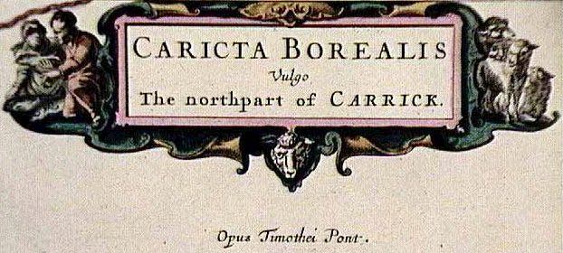
Title: Caricta Borealis.
Mapmaker: Blaeu, Joan. Date: 1654.
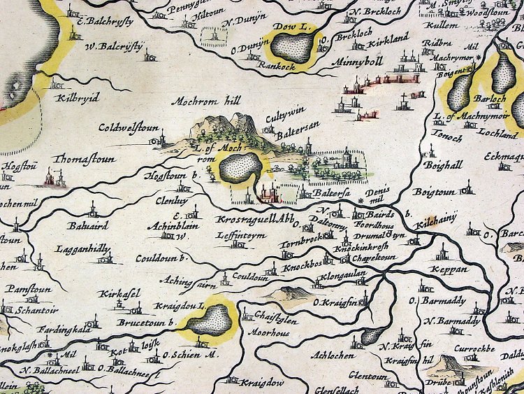
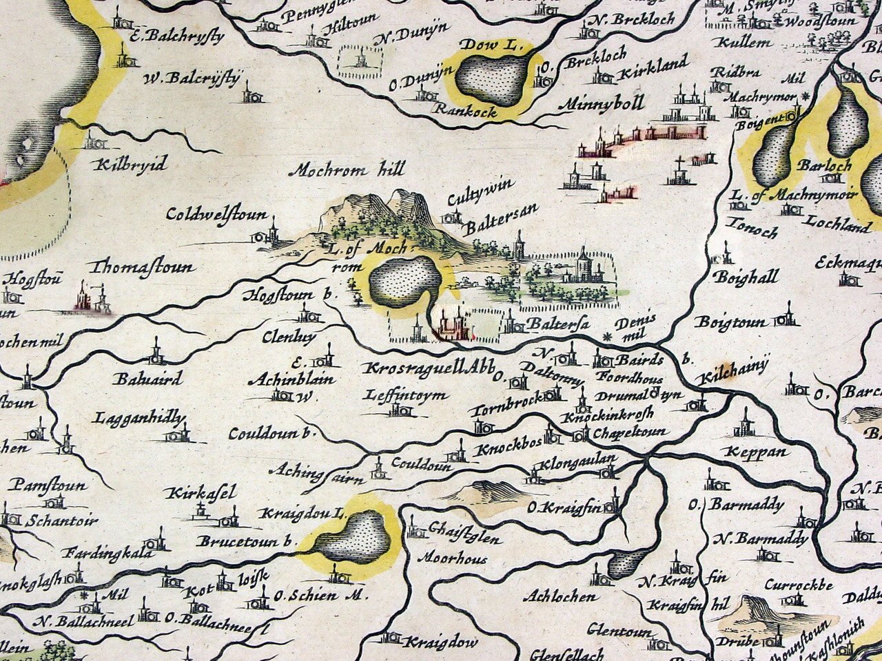
This map is one of the first published maps (i.e., non-manuscript map) of this part of Scotland. It is based primarily on the work of Timothy Pont. Timothy Pont, a minister, was the pioneer Scottish cartographer. From 1583 on, he surveyed the whole of the Scottish mainland and islands, apparently by himself. Unfortunately, he found no patron to publish his maps and his manuscript maps remained unpublished for many years (his map of Lothian and Linlithglow was used in the 1630 Mercator/Hondius atlas). In the mid-1600s, Robert and James Gordon, also early Scottish cartographers, revised and edited the manuscript maps of Pont. Just how much new information they contributed is still the matter of some debate. Joan Blaeu used the manuscript maps of Pont and the Gordons as the basis for the Pars Quinta of his Theatrum Orbis Terrarum first published in 1654. This volume of the Theatrum, the famous Blaeu world atlas, consisted of 55 maps of Scotland and Ireland, including 46 detailed maps of specific regions of Scotland. This was the very first atlas of Scotland and the maps the first detailed maps of most areas of Scotland published. There were some earlier published maps of Scotland (e.g., in the atlases of Ortelius, Mercator, Hondius, Jansson and others) but these are typically single maps of larger areas (with the exception of the single map of Pont mentioned earlier). The Blaeu maps of Scotland are relatively scarce. All of the Blaeu maps can be considered scarce, because of their age and the limited numbers originally produced. The Scotland maps were particularly few in numbers. The maps of Scotland were only produced between 1654, the date of their first printing, and 1672, the year of the fire that destroyed the Blaeu printing house. This is a much shorter period of time than for most of the other Blaeu maps. This is one the first detailed maps of this part of Scotland ever published, making it cartographically significant. This is particularly true of this map since this appears to be a copy of the first edition map put out in 1654. Like all of the early maps of Scotland this map has many place names and localities shown that are important outside of Scotland. Scottish people were among the early settlers in Canada and the United States and many Scottish names have been used for naming localities in North America. Many of the names also have strong recognition for many people because of historic or cultural associations. Maps that have such connections are often more sought after. |